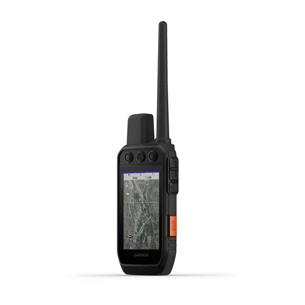
Garmin Alpha 200i device with Topo Drive Hellas map
Track your dogs with the Alpha 200i system with inReach® satellite technology via Iridium, user-friendly 3.5-inch sunlight-readable capacitive touchscreen and six-button design.
DOG LIST/ TEAM MANAGEMENT
Keep inactive dogs in your dog list and manage active groups so you don't have to add or remove dogs.
MONITOR YOUR FLOCK
Track up to 20 dogs at a distance of up to 14 km (depending on the dog's device) with a refresh rate of every 5 seconds.
6 KEYS DESIGN
Use dedicated keys for fine adjustments in the field.
PRO VIEW COMPASS
The pro view compass feature gives you easy at-a-glance tracking that shows the direction and distance your dogs are, plus you'll be able to see when your dog is "running" or "parking".
MULTI-GNSS SUPPORT
Access multiple global navigation satellite systems to locate your herd more accurately than with GPS alone.
EUROPEAN TOPOACTIVE MAPS
TopoActive Europe pre-loaded mapping provides you with detailed views of land contours, topographic elevations, peaks, parks, coastlines, lakes, rivers and geographic points.
BIRDSEYE SATELLITE IMAGERY
Download BirdsEye satellite imagery directly to the device for a realistic view of the course, trails, clearings and more.
NAVIGATION SENSORS
The barometric altimeter helps you accurately record ascent and descent and see short-term barometric pressure trends, while the tilt-compensated three-axis electronic compass helps you keep your bearings regardless of whether you're moving.
SEE ALL
The sunlight-readable 3.5-inch display makes it easy to interact with maps, dog data and more.
STAY IN MOTION
The battery lasts up to 20 hours, or up to 15 hours with inReach technology enabled
TOPO DRIVE HELLAS
Topo Drive Hellas is a combination of road and topographical map that covers on-road and off-road navigation needs and is specially designed for Garmin devices. It is the map that will lead you to your destination by car and will continue to guide you on your hiking, mountain climbing, hunting or cycling and motoring journey.
Topo Drive Hellas has included all the information of the AutoDrive Hellas map, the map used in car navigation devices. It includes 412,000 kilometers including dirt roads throughout Greece, 12,500 cities and settlements with full analysis and 195,000 points of interest, 41,000 toponyms such as mountain peaks and the entire hydrographic network of Greece (lakes, rivers, springs). In addition, it includes a 1:5,000 3D digital model, level curves every 10 meters and a 5,000 km path network.
TWO-WAY EXCHANGE OF MESSAGES
Text your loved ones, post to social media, or communicate with other inReach devices in the field. (satellite subscription required).
INTERACTIVE SOS
In an emergency, trigger an interactive SOS message to GEOS, a professional 24/7 global recording and response center (satellite subscription required).
LOCATION SHARING
Record your location and share it with those at home or out in the field so they can see your progress or ping your device to pinpoint your location with GPS and more (satellite subscription required).
100% GLOBAL IRIDIUM® SATELLITE NETWORK
Instead of relying on your mobile coverage, your messages, SOS alerts and logging are now routed through the IRIDIUM global satellite hub (satellite subscription required).

